ONLINE CATALOGS

Latest Activity

Wednesday, December 19, 2012

Antwerp: Tourism


Tourism


The province harbors several historical cities, such as AntwerpMechelenTurnhoutHerentals and Lier. The Campine region is becoming a popular destination for tourists searching for a quiet and relaxed weekend. Old farms were transformed into bed and breakfast-hotels, the restaurant and café business is very active and an ingenious network for bicycle tours has come to life the past few years. Here and there still up to several dozens acres of large heathland - and forests, such as the Kalmthoutse Heide (E: Kalmthout heathland) in Kalmthout, the moors around Turnhout, the Liereman (Oud-Turnhout) and the Prinsenpark in Retie. In a number of villages one can still see the typical Campine langgevelboerderijen (E: long facade farms).
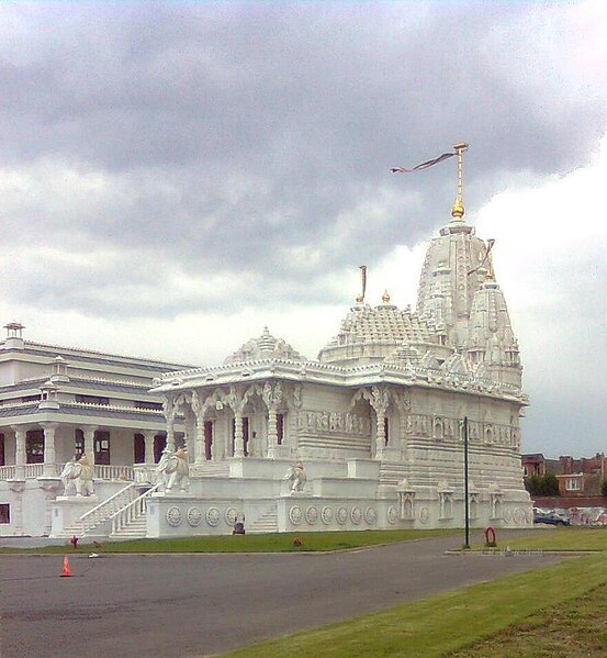
Jain temple in Antwerp, Belgium

Jain temple in Antwerp, Belgium


The Jain community in Europe, especially in Belgium, is mostly involved in the very lucrative diamond business.
The Jains in Belgium are estimated to be around about 1500 people. The majority live in Antwerp, working in the wholesale diamond business. Belgian Indian Jains control two-thirds of the rough diamonds trade and supplied India with roughly 36% of their rough diamonds. They are building a major temple in Wilrijk (near Antwerp), with a cultural centre. Their spiritual leader, Ramesh Mehta, is a full-fledged member of the Belgian Council of Religious Leaders put up on 17 December 2009.

Antwerp: Traffic Infrastructure


Traffic infrastructure

The province has a network of roads, railroads, canals and rivers which provide a modern infrastructure. Historically, the traffic infrastructure was an important element of connecting the Port of Antwerp with the Ruhr Area in North Rhine-WestphaliaGermany. Both the Iron Rhine railroad and the E313 (King Baudouin highway) and E34 highway connect Antwerp with the Ruhr Area.
The river Schelde, an important waterway, connects the Port of Antwerp with the North Sea. The Albert Canal connects the Scheldt in Antwerp with the Meuse and Liège. Other canals are the Canal Dessel – KwaadmechelenSchoten – Turnhout – Dessel, andHerentals – Bocholt which flows into the Nete canal.
Of the International E-road network, the E313E19, and E34 run through parts of the province. The Kennedy Tunnel and the Liefkenshoek Tunnel connect the highway network of the province with East Flanders and Ghent. In addition a newOosterweelconnection is under consideration.
The railroads connect the major cites of the province, such as AntwerpMechelenHerentalsTurnhout and Mol. The Iron Rhine connects Antwerp with Mönchengladbach in Germany. The new High Speed Train connects Antwerpen-Centraal railway station withBrussels (HSL 4) and Amsterdam (HSL-Zuid) at high speed. Antwerp International Airport, located in Deurne is a regional airport.

As in all Flemish provinces, the official and standard language of the Antwerp province is Dutch


Language

As in all Flemish provinces, the official and standard language of the Antwerp province is Dutch. Common with Flemish BrabantNorth Brabant and Brussels, the local dialect is a Brabantian variety.

Belgium: Antwerp - Coat Of Arms

Belgium: Antwerp - Coat Of Arms

Belgium: History Of Antwerp

Location Of Antwerp On Map Of Belgium

History

During the early Middle Ages the region was part of the Frankish Empire, which was divided into several pagi. The territory of the present day province belonged to several pagi of which the region around Antwerp belonged to the Pagus Renesium. The Pagus Toxandria stretched from North Brabant into the Campine region. To the south there was the Pagus Bracbatinse and the Pagus Hasbaniensis. In 843 the Carolingian Empire of Charlemagne was divided among his sons and the river Scheldt became the border between West Francia and East Francia. In 974 Otto II established the Margraviate of Antwerp as a defence against the County of Flanders.
In 1106, Henry V granted the Margraviate to Godfrey I of Leuven. His descendants would from 1235 onwards become the Dukes of Brabant and the region itself was the northern part of the Duchy of Brabant. In 1430 the Duchy became part of the County of Burgundy until 1477 when it fell to the House of Habsburg. In 1713, at the end of the Spanish Succession War the region became part of the Austrian Netherlands until 1794, with in 1790 the short lived United States of Belgium. On 1 October 1795 the former Austrian Netherlands were annexed by France under the French Directory.
The modern province was created as the Department of the two Netes during the First French Empire (when the Southern Netherlands were part of France). After the defeat of Napoleon, the territory became part of the United Kingdom of the Netherlands as the province of Antwerp. In 1830, after the Belgian Revolution the province kept its name.

Prefects from 1800 until 1814

Prefects of the Department of the two Netes during the First French Empire

Governors from 1815 until 1830

Governors of the province of Antwerp during the United Kingdom of the Netherlands

Governors since 1830

Governors of the Belgian province of Antwerp

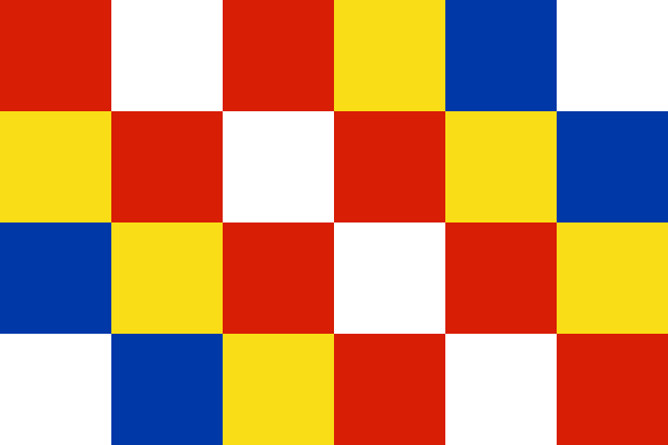
Belgium: Flag of Antwerp

Belgium: Flag of Antwerp


Antwerp  is the northernmost province both of the Flemish Region, also called Flanders, and of Belgium. It borders on (clockwise from the North) North Brabant province of theNetherlands and the Belgian provinces of LimburgFlemish Brabant and East Flanders. Its capital is Antwerp which comprises the Port of Antwerp. It has an area of 2867 km² and with nearly 1.7 million inhabitants it is the country's most populous province. The province consists of 3 Arrondissements, Antwerp, Mechelen and Turnhout. The eastern part of the province comprises the main part of the Campineregion.